Brief
Volcanic activity has started near Ejyafjallajokull, Iceland at a place known as Fimmvorouhals on March 20, 2010 around 23:52 GMT.
 Photo: ©RAX/mbl.is
Purpose
The purpose of this post is to locate the exact position of the Volcanic activity on Google and NASA Maps and identify the fissure from where the eruptions are coming out.
Details
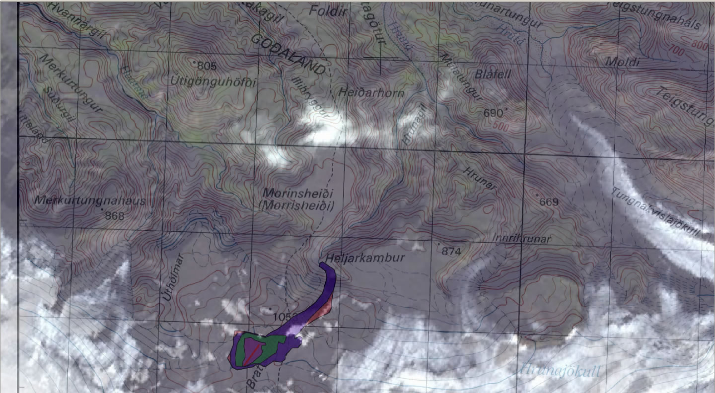
The fissure from where the eruption is currently occuring is oriented NE-SW and is located at N63º38.1, W19º26.4
The base image from where i got the locational reference of Volcanic activity is from Nordic Volcanological Center, Institute of Earth Sciences, University of Iceland.

 Imagery Courtesy: Institute of Earth Sciences, University of Iceland
I tried to locate this position on Google Earth Maps, but in the Google imagery the land is covered with ice and faintly demarking the fissure. As an alternate source i have also choosen an imagery availabe from Aster Volcano Archives, NASA.
| Google Maps imagery |  | NASA Archives imagery |
 | | |
 | |  |
 | |  |
Note: there is a change in imagery as we further zoom-in in google maps.
| |  |
 | |  |
The fissure from where the volcano is erupting can be noted as a dark shade in NE-SW direction.
Link for Google Imagery.
LINKLink for NASA Imagery.
LINK(2.8 MB Jpeg file)
Sources:
Images, News, Data has been collected primarily from the following sources without permission, for non-profit public information.
1.
Institute of Earth Sciences, University of Iceland
2. NASA JPL AVA
3. Google Maps
References
There is a ScienceBlog Post regularly followed and updated on this activity.
LINK